
Tools we build for field crews, survey and GIS work, and small businesses. Each one started as something we needed ourselves.
Track Wizard
Every pass, one clean line.
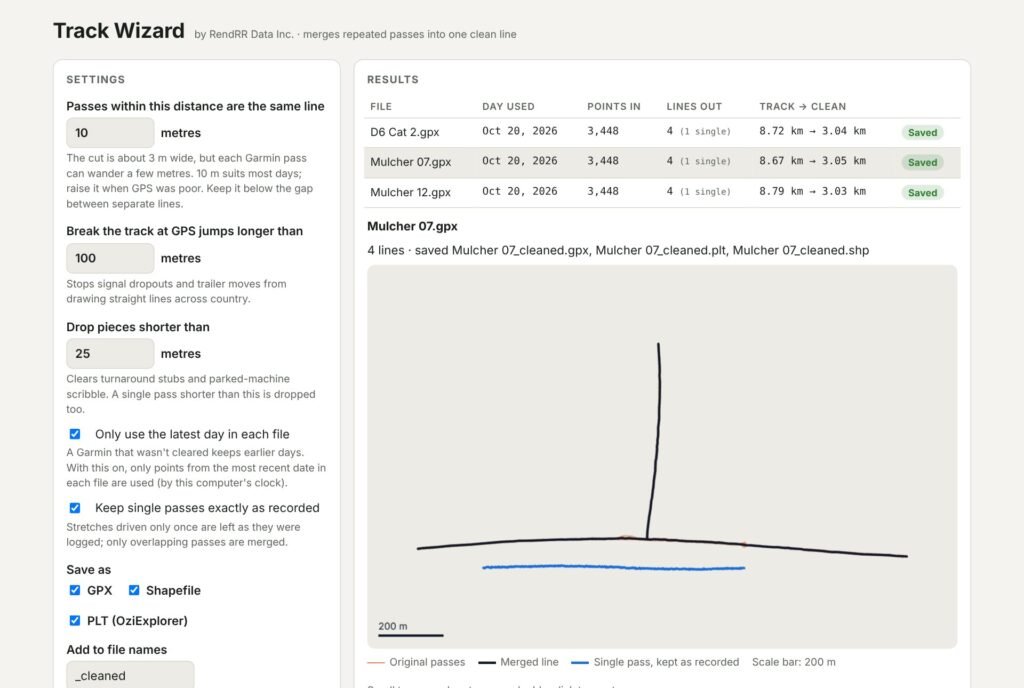
Mulchers and dozers cover the same line more than once, and every pass comes home as another GPS track. Point Track Wizard at a folder of Garmin GPX files and each machine’s overlapping passes become one clean centreline, ready for your mapping software.
- Merges repeated passes into the average line, keeps single passes as recorded
- Uses only the latest day on each Garmin
- Saves GPX, Shapefile and OziExplorer PLT
- Runs on your own computer in Chrome or Edge; nothing is uploaded
Open Track WizardSign-in required · request access at service@rendrr.ca

Go2Hub
All your links. One home.
The page your audience lands on when they tap “link in bio”: your name, your links and your photos at go2hub.net/you. Simple to set up, fast to load, and priced for small businesses and makers.
- Unlimited links on one clean profile page
- Photos and extra customization on Pro
- 30 days free on Basic, no card needed
Outpost Maps
Your maps, your GPS, no signal needed.
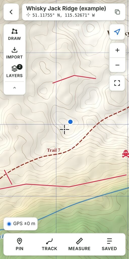
Load the geospatial PDFs, GeoTIFFs and KMZ maps your project already uses, then see exactly where you are on them, offline. Drop pins, record tracks, draw lines and areas, and bring in shapefile, GPX and KML layers. Works on iPhone and Android.
- GPS on your own georeferenced maps, fully offline
- Pins, tracks, drawing and measuring; export to KML or GPX
- Layers with custom symbols, plus an online street or topo background map
- Accounts with cloud backup; free 10-day trial